
Sweaty and sunburned, with aching feet and back pain, I had walked my first marathon — and hadn’t yet reached my destination. It felt like I was a character in a video game: I was Mario, perpetually moving forward, barely taking in this backdrop of sky and concrete, and avoiding obstacles (him: pipes, me: cars and trash). We both hopped on bricks. Mario to fetch coins, and me to feel alive. To keep the pep in my step.
The noise in my ears was no longer decipherable to me. The headphones trapped too much heat and made me uncomfortable.
I craned my neck to check out my shoulders. Burned even worse than my arms and chest. I was grateful I had remembered a baseball hat. When I started walking, about seven-and-a-half hours prior, it had been cold. I almost wore a sweater.
Only four more miles to go. I had been averaging a mile every 16 minutes. At this rate, I had another hour of walking to reach my destination. Why was I doing this to myself? I texted my boyfriend, Ben, my location. I had been texting him throughout the day, but as the sun got higher and higher in the sky, my texting increased.
He was supposed to pick me up when I was done, and I needed him to be ready. I was so tired and wanted to go home. But I dug myself into this hole. I felt bound to finish what I had started: a walk from South Los Angeles to the Verdugos, and then all the way to the ocean, by way of Venice Beach.
Why would someone possibly do that to themselves? A reasonable human may wonder.
What can I say? I had wanted to go on an adventure walk. To discover something. I wanted to go far and wide and reach uncharted-on-foot territory.
I had grown up in New York City, where walking became a part of my identity. It wasn’t just a mode of transportation; it was a way of life. Sure, I could take the subway and get downtown in 30 minutes…or I could leave a half-hour earlier and ~ w a l k ~ all the way down.
In the subway, I could spot rats running along the tracks. While on the streets, I got to bask in the breeze and the greenery by the Hudson, or walk through the streets filled with kids testing the strength of their own voice through their squeals of glee, and exhausted parents, and the smell of fresh babka baking — yes, I grew up on the Upper West Side.
But it wasn’t just the rom-com-worthy magic of my childhood stomping grounds. In college, I became known for my love of walking.
When I moved to Los Angeles, my sense of identity was called into question. In a city made for cars, how would I manage literally and figuratively to keep my feet on the ground? Since walking felt vital to my mental health and overall happiness, my next steps after the move West were important.
Los Angeles is iconically massive and decentralized, which makes walking for everyday transportation highly impractical. Even a mix of walking and mass transit can be unreasonable. Twice as many people live in New York City, compared to the population of Los Angeles, yet the city of LA is more than 50% larger geographically. While mass transit can solve some of the problems, the current system in Los Angeles cannot support the widespread nature of the city; so, we turn to cars.
Since I wouldn’t be getting any steps during my daily drives, I needed to find another way to support my walking habit. While I dabbled in the running scene, I wound up going on deliberate morning walks specifically to fulfill my desire and my need to walk. Although running satisfies a great urge in me, and as inclusive as I found groups like the Pasadena Pacers and A Runner’s Circle, walking plays a different role. There’s a high that comes with running, but walking serves as a meditation. The slower pace allows me to really process the things I encounter.
When I would walk in Manhattan, I saw one neighborhood transition into the next, sometimes a very different environment. And because many of my New York walks were for transportation, my routes regularly varied, unlike my walks in LA, which remain the same, mainly because near my place in Thai Town, there’s one main walking option that isn’t completely dirty, flat, and ugly, but offers a healthy dose of greenery. I needed to shake things up and walk from neighborhood to neighborhood. To really dig my feet into this city.
A nice, long walk might just do the trick, I thought.
When scheming this massive walk through LA, I wasn’t intimidated by the distance. I had trained for a marathon, at least for a brief time, before I was stopped in my tracks by the silent runner-killer: tendonitis. Ironically, I developed tendonitis after running too far after a very long break. I had to curb the runs, and even the walks, to prevent the inflammation and pain from worsening.
And yet, I was certain that walking by myself, at my own pace, on a predetermined path for an extended number of miles would not pose any problems.
I mapped my route and destination.
I was going to start at the Watts Towers, pass through the Verdugos, and end in Venice Beach. When I reached the beach, I figured Ben would pick me up and drive me back. Little did I realize where else my walking tour of the city would take me.
6:40 AM on a random Wednesday in May, I began my adventure walk at the base of the Watts Towers: made from simple tools, broken glass, pottery, tile, wire, steel, cement, and seashells, they stood tall, enduring. The architect had done something big and impactful, and his community protected it.
Prior to this expedition, I had never seen the Watts Towers. Sculptor and Italian immigrant Simon Rodia began their construction back in 1921, and continued on for about 30 years. Rodia passed away in 1965, the same year of the Watts rebellion, which led to six days of civil unrest in the area. During that time, 1000 people were injured, 34 died, and $40 million in property was damaged, yet the Watts Towers remained unscathed, a testament to the power of art in building community identity and pride. Rodia once said of his work, “I had in mind to do something big, and I did it.”
As I drove to the starting point of my trek, the neighborhood still felt sleepy. The sky was getting light, but the streets were empty, save for a man getting into his truck, presumably going off to work somewhere. We smiled at each other and nodded cordially.
It was time to say goodbye to my boyfriend Ben, and the ease of the car, and specifically the passenger seat. I stepped out, enveloped by a wave of cool air. Perfect walking weather.
I sort of skipped in the direction of the Watts Towers, jonesing to get a good look. There was something powerful about seeing it before the world has woken up. Practically alone. It felt like a watch tower, offering eyes and ears, protection, for the people who live around it. It’s shaped somewhat like a sailboat, but it reminded me of these silver minimalist conic Christmas tree-spirals my mom used to put out during the holidays. Or the bones of an amusement park. They announced themselves so loudly, and felt prime for people and life; it made me feel almost shameful for taking my first glance with no company.
But I had no time to linger. If I wanted to make it to Venice before nightfall, I should get moving. I went north; my eyes set on Downtown. I was eager to notice everything. Mere blocks away from the Watts Towers, I passed by the above-ground Watts Historic Train Station, still in use from the Pacific Electric Railway’s streetcar system that used to rule this city.
Cars first hit the streets before the turn of the century, but only became the preferred mode of transport in the 1910s just as the population of Los Angeles reached a population of 319,198, making it the 17th-largest city in the country. By 1915, there were 55,000 cars on the streets of Los Angeles, and – by 1924 – the population would triple, to top one million. In 1926, Highway 66 connected LA to Chicago, and thus became the nation’s first “all weather” roadway between the two cities. The more popular name is “Route 66,” even spawning a TV series about it in the 1960s. The growth of the city, and its reliance upon cars and motor vehicles boomed seemingly symbiotically, while creating loathsome pollution and congestion.
By the 1920s, traffic congestion had become a glaring issue. No one was happy. The rich and the poor were stuck in gridlock or unable to get where they needed to go in a reasonable time. Rich West Siders with Downtown business ventures got to lobbying. First, parking measures were proposed to discourage rush-hour traffic. But once that threatened commerce, a new solution was proposed: widening the streets. Downtown business interests and drivers alike supported this development, while other groups called for the creation of a subway system. Despite the understanding that a well-functioning public transportation system would do the city good, the initial cost was so intimidating, the push lacked support. Part of the reason the price point was so exorbitant was the spread of the city itself. Given the need for a large footprint of any mass transit system, the costs could not be covered locally. They would require substantial subsidies for sufficient funding. At the same time, the reliance on cars as the preferred method of transport further contributed to the decentralization of the area as its population continued to grow in numbers and in all geographic directions.
I found myself among commuters at the Watts Historic Train Station, which was one of the first major railway stations. A few blocks later, I paraded past a community garden, where a city worker cleaned litter from the streets. We exchanged sunny “hellos.” By the time I reached 52nd Street, I had already passed by two Tam’s Burgers, a California burger chain, founded in 1971, that also serves Mexican food. While the spread-out nature of Los Angeles oftentimes makes it feel like a suburb, a flurry of street vendors parked on 43rd Street, selling all kinds of knickknacks and clothing, dispels that notion.
8:47 AM at 28th Street, I spotted my third Tam’s of the walk, and felt like I was in a strange loop filled with chains and strip malls.
The prevalence of strip malls in this city is directly tied to the popularity of cars as mode of transportation. Though aesthetically uninteresting, the public “voted with their feet,” said Zev Yaroslavsky, director of the Los Angeles Initiative at UCLA’s Luskin School of Public Affairs.“They were very convenient, and that’s why they got built. They rented to businesses which served the needs of people, and they made money for the developers.”
By 1985, there were about 3,000 strip malls in Southern California, which was colloquially regarded as “the mini-mall capital of the world.”
8:54 AM Before I knew it, I had reached the Lincoln Theatre, colloquially referred to as “West Coast Apollo.” For every ounce of monotonous, franchised capitalism, there was evidence of culture to balance the city out. For every Rite-Aid, there were a number of local businesses. Some I had heard of, but most, I had not.
I turned off Central onto 23rd street, which quickly became residential. Three dogs barked upon my passing, reminding me of Greek mythology and the three-headed dog that guides the gates to the underworld, Cerberus. Then again, perhaps Bertolt Brecht’s poem, On Thinking About Hell, was just ringing in my memory, not allowing me to think of anything else. Haunting my vision of the city I was in.
On Thinking About Hell
By Bertolt Brecht
On thinking about hell, I gather
My brother Shelley found it was a place
Much like the city of London. I
Who live in Los Angeles and not in London
Find, on thinking about Hell, that it must be
Still more like Los Angeles.
In Hell too
There are, I’ve no doubt, these luxuriant gardens
With flowers as big as trees, which of course wither
Unhesitantly if not nourished with very expensive water. And fruit markets
With great heaps of fruit, albeit having
Neither smell nor taste. And endless processions of cars
Lighter than their own shadows, faster than
Mad thoughts, gleaming vehicles in which
Jolly-looking people come from nowhere and are nowhere bound.
And houses, built for happy people, therefore standing empty
Even when lived in.
The houses in Hell, too, are not all ugly.
But the fear of being thrown on the street
Wears down the inhabitants of the villas no less than
The inhabitants of the shanty towns.
After about two hours of walking, I was confronted by the conflicting elements of downtown. On the one hand are expensive new developments with artificial grass and shiny art objects in their lobbies, and on the other: Skid Row.
Skid Row has become home to many unhoused residents, despite the Community Redevelopment Agency’s removal of public toilets in the area. Los Angeles has become known for its routine sweeps to push unhoused people from the wealthy – or rapidly gentrifying – streets. LA has tried many ways to disperse the unhoused, including removal of public toilets, confiscation of belongings, and destruction of temporary housing structures.
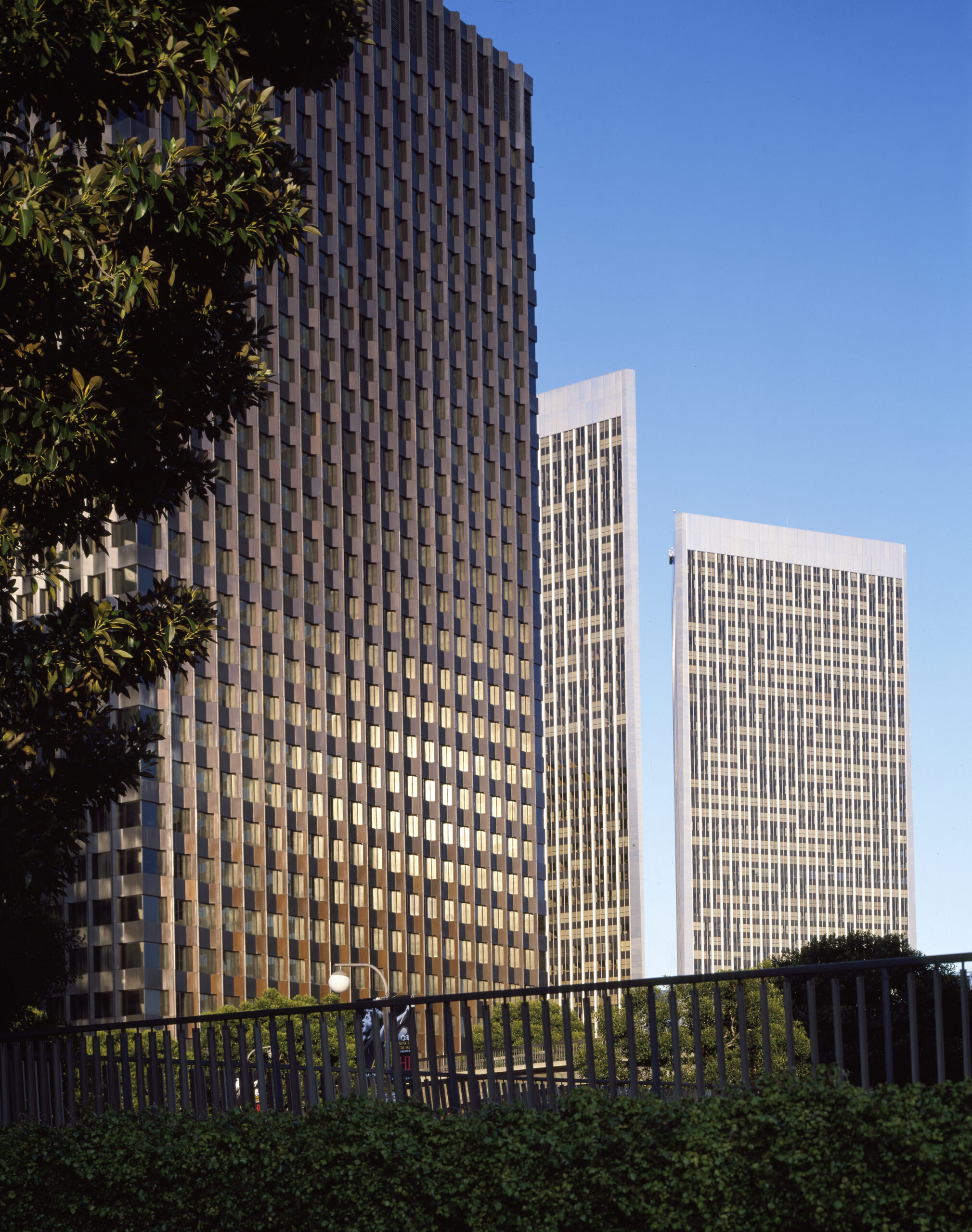
But that’s not the downtown I was traversing. I was in the DTLA constructed to satisfy the platonic ideal of the American downtown. In most U.S. cities, “downtown” refers to the economic, social, and cultural hub, not the geographic location. But in LA, it’s not so simple. It’s a two-headed beast, split not between “downtown” and “uptown,” but between “downtown” and the “west side.”
9:12 AM the DTLA I saw that morning was just waking up. Women were selling fruit, while torso-less mannequins were lined up, booty-out bearing multi-colored, and patterned, leggings. Police helicopters twinkled forebodingly in the sky above the convoluted highways and downtown area, as shop owners lifted the metal blinds from their stores. Torta stands fired up their burners while two older men wearing suits and too much cologne talked about work just in front of their building’s entrance. Shuttered stores and coffee shops were scattered around, too.
I neared Olive Street, where I was somewhat rerouted by trucks there for construction work, only to be stopped in my tracks by two fire trucks. I headed north, toward the land of fancy new buildings decorated with abstract art. I saw about five people per block, which felt empty — at least to the New Yorker in me. Yet another reminder that I was in LA. In New York, I would have come across hundreds of people already. Not dozens.
9:36 AM I ate an oatmeal chocolate chip MacroBar and trekked up Bunker Hill — like the one in Boston, this one, too, has survived some battles. In 1867, a developer, Prudent Beaudry, purchased much of the hill, which was regarded as dividing downtown from the western end of the city, in order to build homes for the wealthy, complete with impressive views. Former Mayor of Los Angeles, Fletcher Bowron, proposed a low-rent public housing program in the area, but was shut down by wealthy elites railing against “socialism.” Instead, 12,000 low-income residents were displaced from their homes in order to accommodate Bunker Hill’s redevelopment. Historic buildings were demolished and no rehabilitation of the area was planned. The modern landscape of the region didn’t start to appear until 1980.
What I saw that morning were the unmistakable, silver curves of the Walt Disney Concert Hall peaking up in the near horizon: Frank Gehry’s design, an emblem for the city, built in the ashes of real estate previously labeled “undesirable.”
More fire trucks hurried by as The Broad came into sight. The Broad is a contemporary museum named for its financiers, Eli and Edythe Broad, who spent a whopping $140 million for its creation back in 2015. The building has a square roof, but a nuanced shell of an exterior — white and multi-shaped — which diffuses light, and serves as decorative wrapping, tantalizing the passerby with expectations for what is within. Adjacent to the structure is The Music Center, shrouded in scaffolding. The presence of starchitect-made buildings beside in-process build sites is commonplace for the DTLA of today.
I crossed the street and a driver rolled down his window, asking me the whereabouts of some parking lot. I had to admit my ignorance and my inability to help him. Nearly three hours in and these were the first words I’d exchanged with another human. It made me wish I knew the intricacies of parking structures in Downtown Los Angeles.
City workers cleaned the streets of trash as I passed by the Civic Center Metro stop and City Hall.
Red paper lanterns and touches of traditional Chinese architecture announced the next neighborhood of this adventure: Chinatown. Well, the “new” Chinatown. The original Chinatown of Los Angeles was located near Olvera Street, in another part of Downtown.
The Chinese-American population in LA grew substantially post-World War II, once the Chinese Exclusion Act was overturned. This act was the first federal law to prevent an ethnic group from immigrating to the States for fear of disrupting the “order” of certain localities. Even when it was overturned, immigration restrictions remained tight, though there was focus placed on family reunification.
Walking down Broadway, I passed by the original Cathay Bank, founded in 1962; Phoenix Bakery, founded in 1938, which brought traditional Chinese pastries to the area; and Lucky Deli, a Thai and Chinese restaurant by Crispy Pork Gang. The restaurant caught my attention, because Crispy Pork Gang has a few spots local to my area, Thai Town, a subsection of East Hollywood.
10:00 AM the sun was getting hot, and my left foot was developing a blister. But I was making good progress. I could breathe easy once I reached the Verdugos, because then my next stop would be my final: Venice Beach.
I walked past a group of volunteer poll workers entering a training session at the Italian Cultural and Social Center, as I approached the eastern outskirts of Elysian Park, a neighborhood and park, which includes the inimitable Dodger Stadium.
Dodger Stadium is a bit of a municipal mess. It was built in a region known as the Chavez Ravine, which was home to a lower-income, but tightly-knit community composed mostly of Mexican-Americans and Jewish-Americans, until the 1950s. The “Battle of Chavez Ravine ” was a ten-year struggle between developers and residents, for stake over the territory. In the end, homes were bulldozed and the pockets of developers were fattened, as the Dodgers relocated from Brooklyn to the newly-constructed stadium. Despite this controversial history, many Los Angelenos connect their love of the Dodgers with their civic pride and identity. In a way, sadly, it’s the most “American” origin story: built on forcibly-taken land, and requiring enthusiasm from the people who have been harmed and uprooted.
10:38 AM I neared the northeastern edge of Elysian Park, and spotted an abnormal amount of concrete, even for LA. I knew what that meant: I had reached the LA River aqueduct, which brings water from the Owens River to the big city, despite many efforts to disrupt the seemingly parasitic relationship Los Angeles has on the water-abundant Owens Valley. I followed the path beside the river until the sidewalk ended, and I was forced to cross to the other side of the road, dodging speeding cars.
11:18 AM I was in Glendale. Located in the Verdugos; peak Suburbia.
11:42 AM I stopped at Ritual Acaí in Atwater for the biggest acaí bowl they sold — with so many toppings.
After writing about LA with all her complexity, it feels self-indulgent and strange giving myself the space, and the words, to talk about how I dealt with this walk. What I consumed to get through it. I took this walk from a place of immense privilege. I walked this far because I wanted to, not because I had to. Not because I needed to get somewhere and couldn’t afford a car or gas, Uber, or bus fare. This whole experience was for fun, not necessity.
I refilled my water bottle as they made my bowl. They didn’t have a restroom. I should have thought of that when picking where to get food.
I sat outside and ate my acaí bowl quickly, feeling animalistic. Bite after bite, I kept going. Wanting to be speedy, yet also wanting to savor the food and the brief respite from the walk. Craving the cold and the calories. The sugar. The napkins kept trying to fly away with the wind, forcing me to pause to protect them from becoming litter.
12:12 PM I was back on the road. I had previously planned on walking down Los Feliz Blvd. I liked the idea of passing by Tam O’Shanter — not another “Tam’s” but a different Tammy establishment. As my friend, Leonora, had recently told me it was one of Walt Disney’s favorite spots to frequent, and is credited with being the inspiration for the cottage in Snow White and the Seven Dwarfs. I’m not a huge Disney person, but the apartment I live in was built in the ‘20s for Disney animators, so I found it to be of particular interest. But the real reason I wanted to walk down Los Feliz is because I wanted to walk through Griffith Park a bit. I wanted to see some greenery in this desert city.
But my feet were sore, and another six hours to go felt long enough, so I opted for the more direct route that the Maps app was suggesting. It kept telling me to turn left, but all I saw was a highway. I paced back and forth, trying to find where I was supposed to be walking.
Generally, using Google Maps, or even the Maps app, is quite convenient and helpful. Of course, not that long ago, people relied on printed maps, which don’t tell you where you are in the scheme of the route. The last time I had a printed map was one I forced my mother to purchase the first time I stepped foot in LA. But it wasn’t just any old map — it was a Map of the Stars. I wondered then if walking home-to-home would have been a more interesting adventure. But perhaps I was just growing fearful that my contrived walk would leave me just as lost regarding my place in this big city.
Here I was, trying to figure out where I was supposed to be going, but I couldn’t seem to find the path forward. I stopped pacing and took a breath. What was I doing? My feet couldn’t handle the superfluous steps. I looked around, searching. And just when I thought I would have to reroute, I saw it. Riverside & Hyperion. Peaking through overgrown vines, tucked in the dry stone bridge, there they were: stairs! Perhaps another relic from the old rail network.
That’s where Maps wanted me to go!
I rushed across the street, looking both ways as I jaywalked through a major intersection. I took the stairs quickly, eager to see what would meet me above. It brought me back to the first time I came to LA with my mother. I dragged her around to all the places, including many old stairwells in Silver Lake and DTLA, that Atlas Obscura deemed cool, and not yet made basic. Or whatever we called things back then. Mainstream?
My favorite stairway in LA is named The Mattachine Steps in honor of the gay rights organization, The Mattachine Society, founded by the late Harry Hay, a resident of the area. The stairs serve as a memorial and offer a great view of the Silver Lake Reservoir. They also offer a great high incline workout, which seems to be what brings many locals to the steps these days.
Anyway, back to the walk at hand! At the top of this stairway, I was met by a highway thick with speeding traffic, and a bridge. I checked the directions, and followed the gray concrete road. Earlier I felt like Mario; now I felt like Dorothy. Though I’m not sure I could do this walk in her shoes.
With each step, I distanced myself from the freeway, nearing the land of cute homes.
I winced, remembering reading about Homeowners Associations in the city, conceived specifically to keep white neighborhoods segregated. It became common practice for owners to advocate for rezoning to prevent poorer neighborhoods from encroaching into wealthier districts, to hoard tax money for their communities. There was even an “Anti-African Housing Association” created specifically to exclude people of color from neighborhoods, though in 1948, the Supreme Court finally ruled against such restrictive covenants. However, the lasting impact of Housing Associations’ bigoted gerrymandering, redlining, and rezoning is undeniable.
I kept my eyes glued to my phone; I didn’t want to get lost. There was no time for that.
12:38 PM Before I knew it, I was in Silver Lake. The sound of speeding cars was replaced by birds chirping so loudly I felt like I was in an animated movie. A perfectly preserved, dead monarch butterfly rested in peace on the sidewalk just beside some floppy white flowers with bright, bulbous yellow centers.
1:14 PM I tried to order an Arnold Palmer at Cafecito Organic, but the surfer-y barista laughed and kindly said, “no way. Hibiscus lemonade is the option,” so I held out, trudging onward past the kitschy, cute vintage shops scattered about Virgil Village.
A bicyclist wearing what appeared to be a Spirited Away mask zoomed past me. Another guy was practicing twirling a stick, presumably to stay relevant in the professional sign-spinning community. It was harder for me to notice my surroundings once I hit East Hollywood. I pass these landmarks so frequently in my daily life that it all began to look like the void I stare into in traffic when driving.
The pain in my lower back was growing worse and worse, so I started squatting when I reached a red light. I’ve run a half marathon before, why was I hurting? I’d walked over 14 miles at this point, but knew I needed a break. Stat.
1:34 PM I needed to sit. I was on Beverly Boulevard near Normandie, and there were no coffee shops in sight. Just shuttered buildings and convenience stores.
I headed for Larchmont. Only two more miles away. In New York, two miles, forty streets or sixteen avenues, feels like nothing. But two miles here feels much greater. I turned to podcasts for company. I had already tried calling some friends, but intense wind and speeding traffic made talking beyond a check-in near impossible.
1:54 PM I got a sparkling iced tea and rested my feet for a good ten minutes. It was the fuel my body needed to gain the fortitude to keep going. What did I think I was doing? I wasn’t running a marathon, after all. I should be able to finish this at my reasonable pace, right?
2:08 PM I trailed a mailman through Hancock Park, and texted Ben that I was getting burned out. Soon after, I realized I was also getting sunburned.
3:10 PM About nine hours into the walk, I had reached the border of Culver City. I was properly on the west side, but still a handful of miles from the ocean. Given my foot discomfort and the sunburn, I realized that I had to pick a new spot to end my walk, and it would not be the beach. I set my sights on the nearest border of Venice.
Every bus that passed by felt like a taunt. Maybe I should just hop on.
You can write about how the Big Blue Bus was founded in 1928! That’s decades before the metro would be created in the early ‘90s. Wild, right?? Right???? Said the voice in my head.
3:22 PM 27 miles in, somewhere in Mid-City, I gave up. My feet were wrecked, my body hot, burned and sweaty. What did I have to prove? That LA was walkable? I knew that wasn’t the case from the start. If anything, my failure proved the point. You can walk in Los Angeles, but the city was not built with the pedestrian in mind.
If I had walked more than a marathon-worth of land in New York, surely memorable moments, and even potentially transformative encounters, would have occurred. But instead, an unhoused man respectfully bowed his head at me, a driver asked for directions to a parking garage, and the LA sun burned me badly.
I squatted on the side of the road as I waited for Ben to come get me. My bright pink baseball hat was the only pop of color on this random, gray block in the middle of West LA.
3:38 PM In the car, I could barely think. I was so grateful Ben had come to pick me up and take me home. I remember the sun feeling bright, but it might have been cloudy by then. I forget, really. It’s all a haze from here on out. Although I had mostly accomplished my goal, I felt depleted and defeated for having fallen just a little short.
I wasn’t in New York anymore. This was Los Angeles. A city spread thin.
“Let’s drive to the beach. I just want to see it,” I said, “We don’t have to get out. I just want to make it there.”
So, in proper LA fashion, we drove.
Works Cited
Bottles, Scott L. Los Angeles and the Automobile: The Making of the Modern City. University of California Press, 1987.
Davis, Mike. City of Quartz: Excavating the Future in Los Angele. Verso, 2018.
Hise, Greg. Magnetic Los Angeles: Planning the Twentieth-Century Metropolis. Johns Hopkins University Press, 1999.
Hutchinson, Maris, et al. “Historical Timeline of Los Angeles.” Discover Los Angeles, https://www.discoverlosangeles.com/things-to-do/historical-timeline-of-los-angeles. Accessed 22 July 2022.
Krist, Gary. The Mirage Factory: Illusion, Imagination, and the Invention of Los Angeles. Broadway Books, 2019.
Meares, Hadley, and Christopher Fowler. “How LA became the land of strip malls.” Curbed LA, 2 October 2019, https://la.curbed.com/2019/10/2/20882316/strip-malls-los-angeles. Accessed 22 July 2022.
Mostyn, Megan. “Chinatown: Colors, History and Architecture.” Dunn-Edwards, 9 February 2014, https://www.dunnedwards.com/colors/specs/posts/chinatown-colors-history-and-architecture. Accessed 22 July 2022.
Podair, Jerald. City of Dreams: Dodger Stadium and the Birth of Modern Los Angeles. Princeton University Press, 2019.
Stewart, Jill. “East Side, West Side : The Tug of War between L.A.’s Rival Realities Is Polarizing the City. but Some Angelenos Are Breaking down the Barriers.” Los Angeles Times, 23 January 1994, https://www.latimes.com/archives/la-xpm-1994-01-23-tm-14517-story.html. Accessed 22 May 2022.